QGIS Server Quickstart
QGIS Server provides a web map service (WMS) based on libraries from the QGIS desktop application.
Tässä Pika-aloitusnäytössä kuvataan, miten:
update an existing QGIS project and render it with QGIS Server
create a new QGIS project and open the WMS directly in a browser
Start GeoExt viewer
OSGeoLive contains an example of web map viewer based on the GeoExt Javascript framework and using QGIS Server for rendering the map.
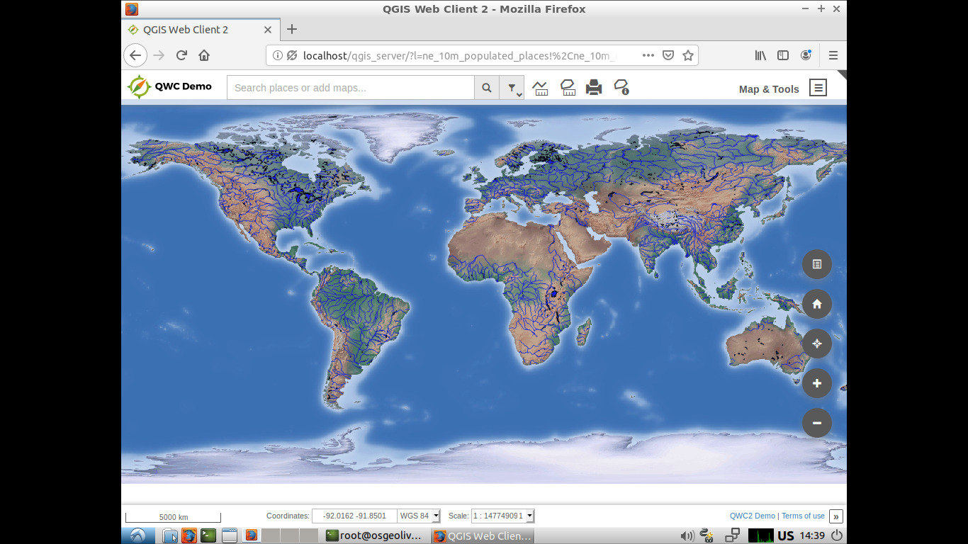
Click . You should see a browser window with a web map viewer showing a world map.

Alternatively, you can access the application using a browser through http://localhost/qgis_server
Muokkaa QGIS-projektia
We will now change the map styling using QGIS.
Click
Choose from the menu bar.
Select
QGIS-NaturalEarth-Example.qgsand press Open.You should see the same world map rendered by QGIS. We will now change river styling and look at the result in the web map viewer.
Double click
ne_10m_rivers_lake_centerlinesin the Layers tree.Change the color in Outline Options to a different blue tone.
Press OK. Rivers are now rendered in a new color.
Save the project with .
Reopen the web browser.
Zoom in. You will now see rivers rendered in the same new color.
Luo uusi QGIS-projekti
Reopen QGIS.
Choose .
Click .
Browse to dataset
/home/user/data/natural_earth2/ne_10m_admin_0_countries.shp.Press Open. You should see all world countries.
Save the project with .
Use file name
/home/user/world.qgzand press Save.Open the WMS URL. You should see all world countries, this time rendered by QGIS Server.
Mitä seuraavaksi?
To learn more about QGIS Server, a good starting point is the QGIS Server Guide.
- Documentation:
Quick start for Server Installation on Debian/Ubuntu:
apt-get install qgis-mapserver libapache2-mod-fcgid
- QGIS Web Client:
