

OWSLib Quickstart
OWSLib is a Python package for client programming with Open Geospatial Consortium (OGC) web service interface standards, and their related content models.
Included with OSGeoLive, OWSLib offers ready-to-use access to OGC services exposed by other bundled geospatial applications.
Contents
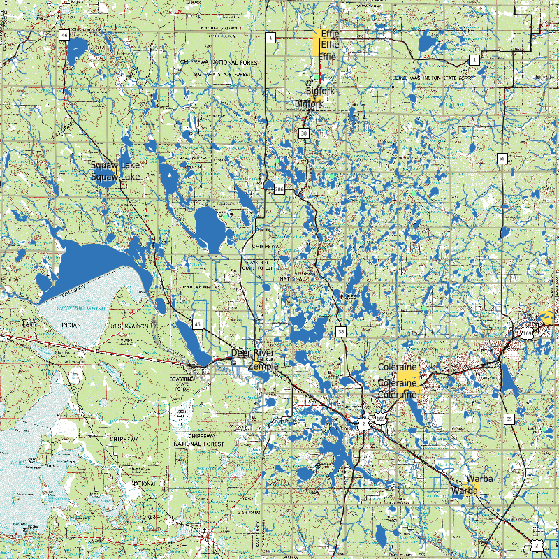
Download a WMS Image from MapServer
An example of connecting to the MapServer demo on OSGeoLive and downloading a WMS image.
$ python3
>>> from owslib.wms import WebMapService
>>> url = "http://localhost/cgi-bin/mapserv?map=/usr/local/www/docs_maps/mapserver_demos/itasca/itasca.map"
>>> wms = WebMapService(url, version='1.3.0')
>>> wms.identification.title
print(wms.identification.title)
>>> list(wms.contents)
['ITASCA', 'drgs',...
>>> wms['mcd90py2'].title
'Minor Civil Divisions'
>>> wms['mcd90py2'].boundingBox
(393234.0, 5207990.0, 495770.0, 5305370.0, 'EPSG:26915')
>>> wms['mcd90py2'].crsOptions
['EPSG:26915', 'EPSG:3857']
>>> img = wms.getmap(layers=['ITASCA'], srs='EPSG:26915', bbox=(393234.0, 5207990.0, 495770.0, 5305370.0),
             size=(800, 800), format='image/png', transparent=True)
>>> out = open('itasca.png', 'wb')
>>> out.write(img.read())
>>> out.close()
Inspect PyWPS Processes
An example of connecting to the PyWPS demo server on OSGeoLive and inspecting the available processes.
$ python3
>>> from owslib.wps import WebProcessingService
>>> wps = WebProcessingService('http://localhost/pywps/wps.py?')
>>> print(wps.identification)
Service: WPS, title=PyWPS Processing Service
>>> for process in wps.processes: print(f"Identifier: {process.identifier}: Title: {process.title}")
Identifier: say_hello: Title: Process Say Hello
>>> inputs = [("name", "OWSLib")]
>>> execution = wps.execute(say_hello_process.identifier, inputs)
>>> output_data = execution.processOutputs[0].data
>>> print(f"Output data: {output_data}")
Output data: ['Hello OWSLib']
Using CSW with pycsw
An example of connecting to the Catalogue Service for the Web (CSW) demo server provided by pycsw on OSGeoLive.
$ python3
>>> from owslib.csw import CatalogueServiceWeb
>>> csw = CatalogueServiceWeb('http://localhost/pycsw/')
>>> print(f"Title {csw.identification.title} Type: {csw.identification.type}")
Title: pycsw Geospatial Catalogue Type: CSW
>>> [op.name for op in csw.operations]
['GetCapabilities', 'DescribeRecord', 'GetDomain', 'GetRecords', 'GetRecordById', 'GetRepositoryItem']
>>> from owslib.fes import PropertyIsEqualTo, PropertyIsLike, BBox
>>> query = PropertyIsEqualTo('csw:AnyText', 'Lorem ipsum')
>>> csw.getrecords2(constraints=[query], maxrecords=20)
>>> csw.results
{'matches': 2, 'returned': 2, 'nextrecord': 0}
>>> for rec in csw.records: print(csw.records[rec].abstract)
Quisque lacus diam, placerat mollis, pharetra in, commodo sed, augue. Duis iaculis arcu vel arcu.
None
Connect to the pygeoapi OGC Features API
An example of connecting to the pygeoapi demo server on OSGeoLive and retrieving a feature collection, using the OGC Features API.
To run the example below on OSGeoLive, first ensure the pygeoapi demo server is running. From the desktop, choose . Then, in a terminal, run the following commands:
$ python3
>>> from owslib.ogcapi.features import Features
>>> service = Features("http://localhost:5000/")
>>> feature_collections = service.feature_collections()
>>> print(feature_collections)
['lakes']
>>> lake = service.collection_items('lakes', name='Lake Victoria')
>>> import json
>>> print(json.dumps(lake, indent=4))
{
"type": "FeatureCollection",
"features": [
    {
        "type": "Feature",
        "properties": {
            "id": 6,
            "scalerank": 0,
            "name": "Lake Victoria",
What next?
OSGeoLive includes a set of Jupyter notebooks, including examples of OWSLib usage, and providing more details on the examples above. From the desktop, choose .
The Doing Geospatial in Python workshop also includes several notebooks demonstrating OWSLib usage.
For more information on OWSLib, please consult the documentation on the OWSLib website.