Run GRASS interface in an R session not started within GRASS. In general,
most users will use initGRASS in throwaway locations, to use GRASS
modules on R objects without the need to define and populate a location. The
function initializes environment variables used by GRASS, the .gisrc used by
GRASS for further environment variables, and a temporary location.
On Windows, if OSGeo4W GRASS is being used, the R session must be started in
the OSGeo4W shell. If not, the non-standard placing of files and of
environment variables confuses the function. If toupper(gisBase)
contains "OSGEO4W64/APPS/GRASS" or "OSGEO4W/APPS/GRASS" (and
after converting "\" to "/"), but the environment variable
OSGEO4W_ROOT is not defined, initGRASS() will exit with an
error before confusion leads to further errors. For further details, see
https://github.com/osgeo/rgrass/issues/16 and
https://github.com/osgeo/rgrass/issues/16.
The same restriction applies to use of GRASS with QGIS Windows standalone
installations, which may be used with initGRASS only if the R session
is started from the OSGeo4W shell shipped as part of the standalone installer
(see https://github.com/osgeo/rgrass/issues/87). The function will
exit with an error if R was not started from the QGIS OSGeo4W shell before
confusion leads to further errors.
The locking functions are used internally, but are exposed for experienced
R/GRASS scripters needing to use the GRASS module "g.mapset" through
initGRASS in an existing GRASS location. In particular,
"g.mapset" may leave a .gislock file in the current MAPSET, so
it may be important to call unlink_.gislock to clean up before
quitting the R session. remove_GISRC may be used to try to remove the
file given in the "GISRC" environment variable if created by
initGRASS with argument remove_GISRC= TRUE.
Usage
initGRASS(
  gisBase = NULL,
  home,
  SG,
  gisDbase,
  addon_base,
  location,
  mapset,
  override = FALSE,
  use_g.dirseps.exe = TRUE,
  pid,
  remove_GISRC = FALSE,
  ignore.stderr = get.ignore.stderrOption(),
  tempdir = base::tempdir()
)

get.GIS_LOCK()

set.GIS_LOCK(pid)

unset.GIS_LOCK()

unlink_.gislock()

remove_GISRC()
Arguments
- gisBase
The directory path to GRASS binaries and libraries, containing bin and lib subdirectories among others; if NULL, set from environment variable GRASS_INSTALLATION if found, if not found,
system("grass --config path")is tried.- home
The directory in which to create the .gisrc file; defaults to
$HOMEon Unix systems and toUSERPROFILEon Windows systems; can usually be set totempdir().- SG
An optional
SpatRasterorSpatialGridobject to define theDEFAULT_WINDof the temporary location.- gisDbase
if missing,
tempdir()will be used; GRASS GISDBASE directory for the working session.- addon_base
if missing, assumed to be "$HOME/.grass7/addons" on Unix-like platforms, on MS Windows "\ and checked for existence.
- location
if missing,
basename(tempfile())will be used; GRASS location directory for the working session.- mapset
if missing,
basename(tempfile())will be used; GRASS mapset directory for the working session.- override
default FALSE, set to TRUE if accidental trashing of GRASS .gisrc files and locations is not a problem.
- use_g.dirseps.exe
default TRUE; when TRUE appears to work for WinGRASS Native binaries, when FALSE for QGIS GRASS binaries; ignored on other platforms.
- pid
default
as.integer(round(runif(1, 1, 1000))), integer used to identify GIS_LOCK; the value here is arbitrary, but probably should be set correctly.- remove_GISRC
default FALSE; if TRUE, attempt to unlink the temporary file named in the "GISRC" environment variable when the R session terminates or when this package is unloaded.
- ignore.stderr
default taking the value set by
set.ignore.stderrOption; can be set to TRUE to silencesystem()output to standard error; does not apply on Windows platforms.- tempdir
a directory to use for temporary files. You may want to provide the same value for
home.
Value
The function runs gmeta6 before returning the current values
of the running GRASS session that it provides.
Details
The function establishes an out-of-GRASS working environment providing GRASS
commands with the environment variable support required, and may also provide
a temporary location for use until the end of the running R session if the
home argument is set to tempdir(), and the gisDbase
argument is not given. Running gmeta shows where the location is,
should it be desired to archive it before leaving R.
Note
If any package command fails with a UTF-8 error from the XML package, try
using setXMLencoding to work around the problem that GRASS modules
declare –interface-description output as UTF-8 without ensuring that it is.
Author
Roger S. Bivand, e-mail: Roger.Bivand@nhh.no
Examples
# Run only if GRASS installation is found and 'terra' package is installed
GRASS_INSTALLATION <- Sys.getenv("GRASS_INSTALLATION")
run <- nzchar(GRASS_INSTALLATION) &&
file.exists(GRASS_INSTALLATION) &&
file.info(GRASS_INSTALLATION)$isdir &&
require(terra, quietly = TRUE)
#> terra 1.8.60
if (run) {
# Get the terra example dataset
f <- system.file("ex/elev.tif", package="terra")
r <- rast(f)
}
# Check for existing GRASS session running
if (run) {
loc_existing <- try(gmeta(), silent = TRUE)
}
#> Warning: cannot open file '/file208c5bb6d4d0': No such file or directory
if (run) {
# Initialize a temporary GRASS project using the example data
loc <- initGRASS(
gisBase = GRASS_INSTALLATION,
home = tempdir(),
SG = r,
override = TRUE
)
}
if (run) {
# Write the example data to the GRASS database
write_RAST(r, "elev", flags = "overwrite")
execGRASS("r.info", map = "elev")
}
#> Importing raster map <elev>...
#> 0% 3% 6% 10% 13% 16% 20% 23% 26% 30% 33% 36% 40% 43% 46% 50% 53% 56% 60% 63% 66% 70% 73% 76% 80% 83% 86% 90% 93% 96% 100%
#> SpatRaster read into GRASS using r.in.gdal from file
#> +----------------------------------------------------------------------------+
#> | Map: elev Date: Fri Aug 29 04:31:18 2025 |
#> | Mapset: file208c17b96033 Login of Creator: runner |
#> | Location: file208c73484a2a |
#> | DataBase: /tmp/grass7-runner-8327/RtmpoVO48Q |
#> | Title: |
#> | Timestamp: none |
#> |----------------------------------------------------------------------------|
#> | |
#> | Type of Map: raster Number of Categories: 0 |
#> | Data Type: CELL |
#> | Rows: 90 |
#> | Columns: 95 |
#> | Total Cells: 8550 |
#> | Projection: Latitude-Longitude |
#> | N: 50:11:30N S: 49:26:30N Res: 0:00:30 |
#> | E: 6:32E W: 5:44:30E Res: 0:00:30 |
#> | Range of data: min = 141 max = 547 |
#> | |
#> | Data Description: |
#> | generated by r.in.gdal |
#> | |
#> | Comments: |
#> | r.in.gdal --overwrite input="/home/runner/work/_temp/Library/terra/e\ |
#> | x/elev.tif" output="elev" memory=300 offset=0 num_digits=0 |
#> | |
#> +----------------------------------------------------------------------------+
#>
if (run) {
# Calculate slope and aspect raster
execGRASS(
"r.slope.aspect",
flags = "overwrite",
elevation = "elev",
slope = "slope",
aspect = "aspect"
)
}
#> 0% 3% 6% 9% 12% 15% 18% 21% 24% 27% 30% 34% 37% 40% 43% 46% 49% 52% 56% 59% 62% 65% 68% 71% 74% 78% 81% 84% 87% 90% 93% 96% 100%
#> Aspect raster map <aspect> complete
#> Slope raster map <slope> complete
if (run) {
# Read the results back into R and plot
u1 <- read_RAST(c("elev", "slope", "aspect"), return_format = "terra")
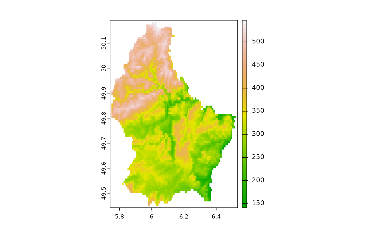
plot(u1[["elev"]], col = terrain.colors(50))
}
#> Checking GDAL data type and nodata value...
#> 2% 5% 8% 11% 14% 17% 20% 23% 26% 30% 33% 36% 40% 43% 46% 50% 53% 56% 60% 63% 66% 70% 73% 76% 80% 83% 86% 90% 93% 96% 100%
#> Using GDAL data type <UInt32>
#> Exporting raster data to RRASTER format...
#> 2% 5% 8% 11% 14% 17% 20% 23% 26% 30% 33% 36% 40% 43% 46% 50% 53% 56% 60% 63% 66% 70% 73% 76% 80% 83% 86% 90% 93% 96% 100%
#> r.out.gdal complete. File
#> </tmp/grass7-runner-8327/RtmpoVO48Q/file208c4ab009d8.grd> created.
#> Checking GDAL data type and nodata value...
#> 2% 5% 8% 11% 14% 17% 20% 23% 26% 30% 33% 36% 40% 43% 46% 50% 53% 56% 60% 63% 66% 70% 73% 76% 80% 83% 86% 90% 93% 96% 100%
#> Using GDAL data type <Float32>
#> Exporting raster data to RRASTER format...
#> 2% 5% 8% 11% 14% 17% 20% 23% 26% 30% 33% 36% 40% 43% 46% 50% 53% 56% 60% 63% 66% 70% 73% 76% 80% 83% 86% 90% 93% 96% 100%
#> r.out.gdal complete. File
#> </tmp/grass7-runner-8327/RtmpoVO48Q/file208ce398663.grd> created.
#> Checking GDAL data type and nodata value...
#> 2% 5% 8% 11% 14% 17% 20% 23% 26% 30% 33% 36% 40% 43% 46% 50% 53% 56% 60% 63% 66% 70% 73% 76% 80% 83% 86% 90% 93% 96% 100%
#> Using GDAL data type <Float32>
#> Exporting raster data to RRASTER format...
#> 2% 5% 8% 11% 14% 17% 20% 23% 26% 30% 33% 36% 40% 43% 46% 50% 53% 56% 60% 63% 66% 70% 73% 76% 80% 83% 86% 90% 93% 96% 100%
#> r.out.gdal complete. File
#> </tmp/grass7-runner-8327/RtmpoVO48Q/file208c6086b54f.grd> created.
 # Restore the original GRASS session
if (run) {
if (!inherits(loc_existing, "try-error")) {
loc <- initGRASS(
home = tempdir(),
gisBase = GRASS_INSTALLATION,
gisDbase = loc_existing$GISDBASE,
location = loc_existing$LOCATION_NAME,
mapset = loc_existing$MAPSET,
override = TRUE
)
}
}
# Restore the original GRASS session
if (run) {
if (!inherits(loc_existing, "try-error")) {
loc <- initGRASS(
home = tempdir(),
gisBase = GRASS_INSTALLATION,
gisDbase = loc_existing$GISDBASE,
location = loc_existing$LOCATION_NAME,
mapset = loc_existing$MAPSET,
override = TRUE
)
}
}